
ūüďĚ About the Author: Matthias
You want to explore Tenerife’s natural beauty but don’t have the stamina or time for grueling day hikes. Then this article is for you. I’ll introduce you to 8 diverse hiking routes on Tenerife that not only capture the island’s impressive diversity but are also easy to reach and range from easy to moderate in difficulty. Plus, I’ll give you plenty of tips for hiking on Tenerife to ensure your nature adventure on this Canary Island is a success.
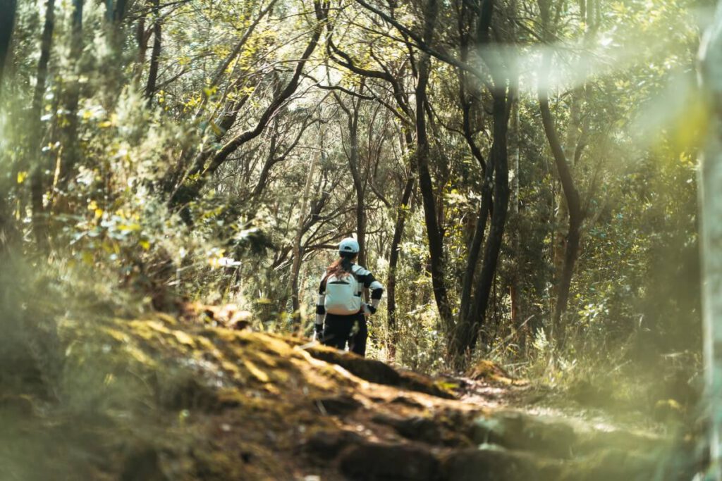
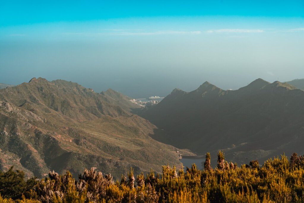
Tenerife is famous for its sunshine and beaches, but if you only visit the well-known hotspots in the south, you’ll miss the true heart of the island. While the coastlines are often bustling, Tenerife reveals a completely different, almost magical side in its unspoiled nature. The best way to discover this quiet beauty? Lace up your hiking boots and head into the more remote regions.

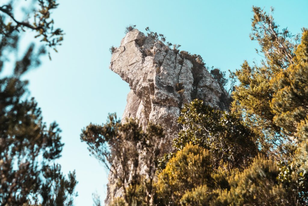
What makes Tenerife special is that it combines many different climate zones within a very small area. This results in an incredible variety of landscapes. One day you might be hiking through misty, jungle-like laurel forests, the next you’ll be strolling through a surreal, treeless lunar landscape, and the day after that you’ll discover deep gorges with hidden waterfalls.
You can easily complete all of the hiking trails in Tenerife featured in this article in no more than 4 hours, and they take you through the following spectacular landscapes:
- Volcanoes: Bizarre lava fields and black sand
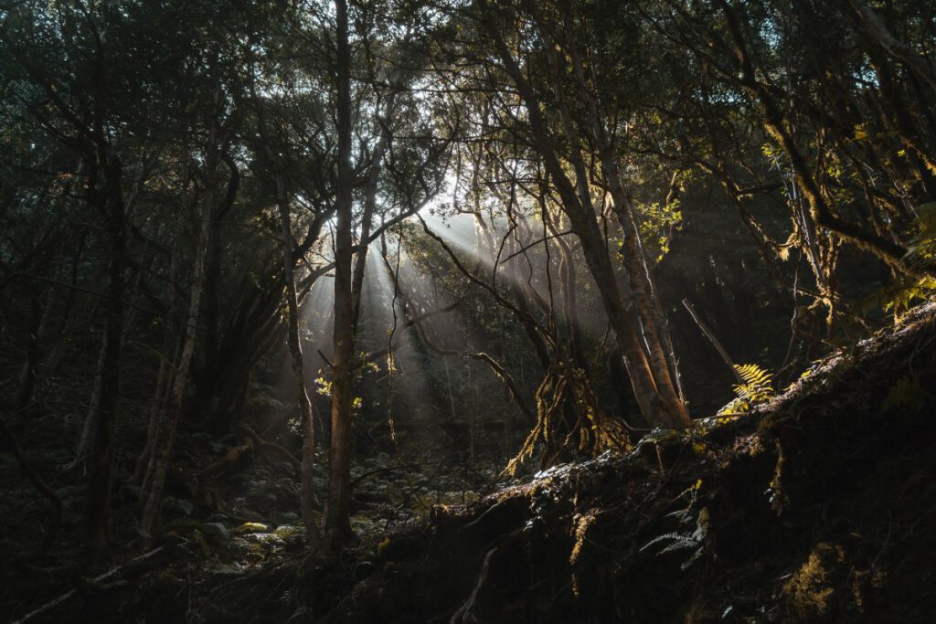
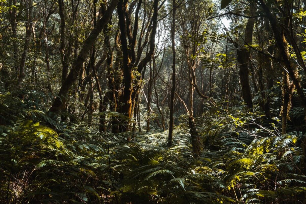
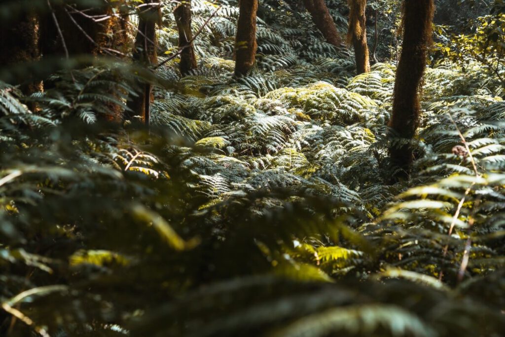
- Jungle: Mystical laurel forests, often shrouded in mist
- Coast: Wild trails with views of the Atlantic
- Forest: Fragrant pine forests with a view of the island's highest peak
- Gorges: Spectacular barrancos and botanical treasures.
Tenerife’s Nature Reserves
There are several types of nature reserves on Tenerife, which vary in size and the strictness of their conservation measures:
- National Park (Parque Nacional): The highest level of nature conservation; the preservation of nature is the absolute priority.
- Natural Park (Parque Natural): Large natural areas that have been largely untouched by human activity; less strictly regulated than national parks, but also focused on nature conservation.
- Integral Nature Reserves (Reservas Naturales Integrales): These are mostly medium-sized areas that are strictly protected and generally cannot be visited without a permit.
- Special Nature Reserves (Reserva Natural Especial): Medium-sized natural areas; the goal is to preserve unique habitats, specific species, geological formations, or important natural and ecological processes
- Rural Park / Nature Park (Parque Rural): Nature conservation combined with cultural landscapes (traditional agriculture and villages)
ūüŹěÔłŹ Interesting fact: Nearly 50% of Tenerife‚Äôs total land area is protected.
Hiking Tips for Tenerife
- Digital companion: You can find most of the public hiking trails on Tenerife via the Tenerife ON app or website. What I really like about the app is that, in addition to official hiking routes, it also provides plenty of information about the island’s various nature reserves.
- Navigation: I would generally recommend always having OpenStreetMap with you. It’s much better than Google Maps for hiking because it shows smaller trails, scenic overlooks, and even waterfalls on the map. I personally always use the free version of the OutdoorActive app, which is also based on OpenStreetMap. But there are other good apps for this as well.
- Printed hiking guide: A printed hiking guide for Tenerife is also a good idea. For example, the Rother hiking guide, which features the most beautiful coastal and mountain hikes, is a good choice.
- Costs: Many of the hiking trails on Tenerife are free. But not all of them. Always check the costs in advance. In most cases, however, you can pay for the trails that require a fee online beforehand.
- Permits: Hiking in specially protected areas is often completely prohibited or permitted only with a reservation. It’s best to check in advance whether you might even need a permit for the route in question. In most cases, there are signs on-site indicating that you’ll face heavy fines if caught without a permit.
- Footwear: For the hikes described in this article, you should definitely bring hiking boots or at least sturdy shoes. Flip-flops or hiking sandals are usually unsuitable.
- Clothing: Even though it’s often almost desert-like in the south of the island, it can still get a bit colder in the mountains and in the north. You should pack clothes for these potential temperature differences. Be sure to pack long pants, a sweater, and a rain jacket. You can always take them off if it gets too warm.
- Other gear: Be sure to bring enough water (1.5 to 2 liters) and sunscreen on every hike.
- Theft: Even though Tenerife is an island, there are occasional reports of thefts at parking lots. Therefore, never leave valuables in your car, especially at hiking parking lots.
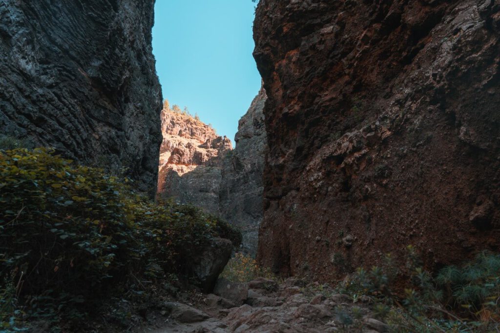
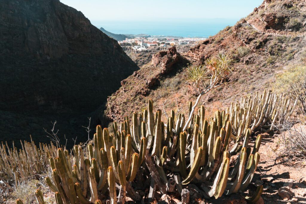
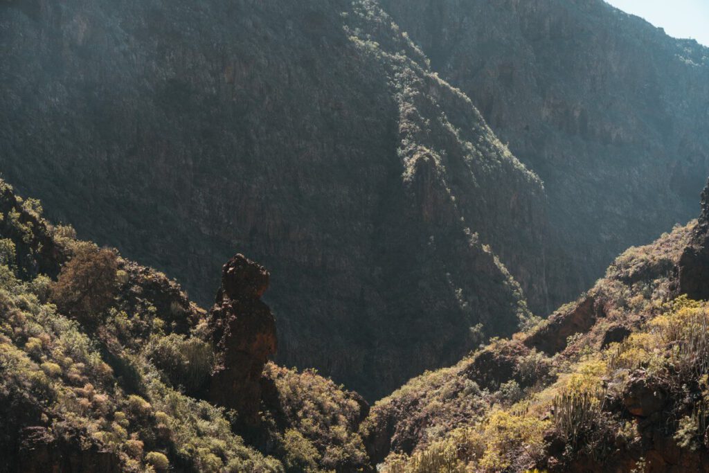
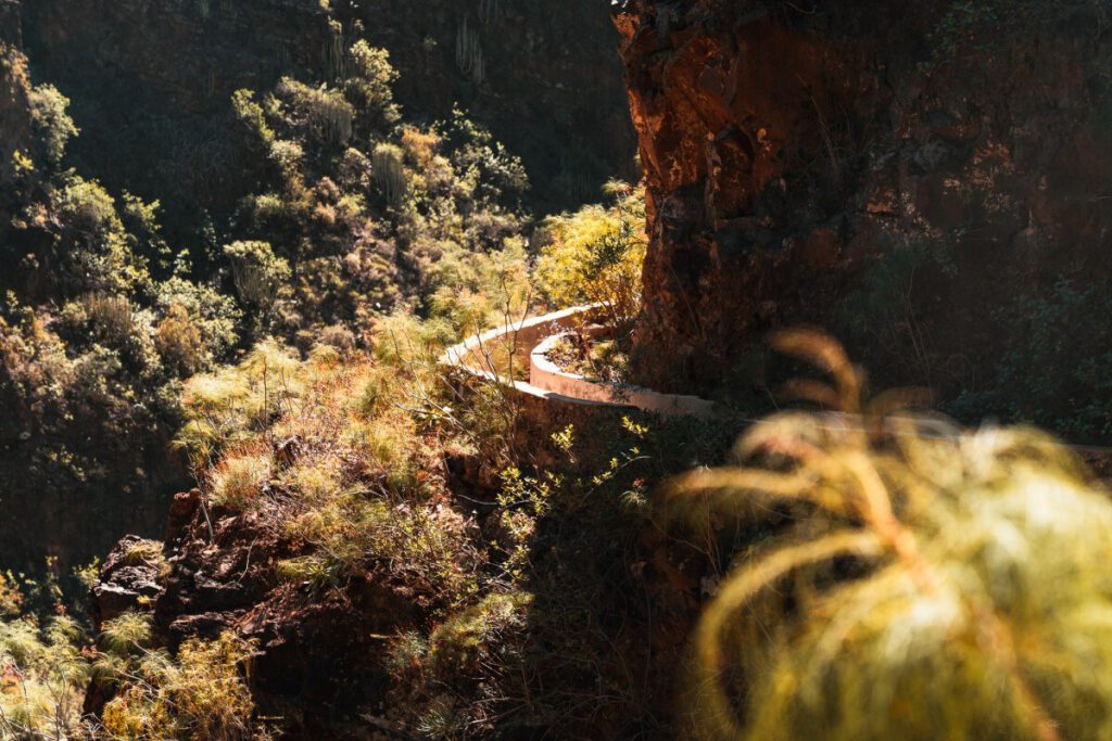
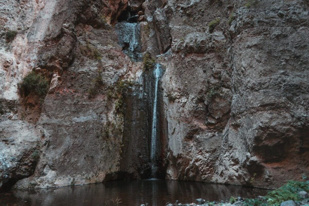
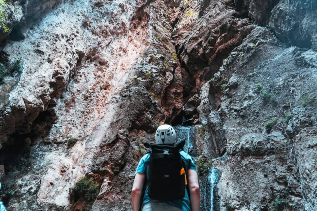
Tenerife Hike 1: Through the Hell’s Gorge (Barranco del Infierno)
- Landscape: Gorge
- Nature Reserve: Barranco del Infierno Special Nature Reserve
- Admission: ‚ā¨15; reservations via the website
- Distance: 6.5 km
- Duration: 3.5 to 4 hours (round trip)
- Difficulty level: medium
- Parking: There is a public paid parking lot (‚ā¨0.90 per hour) just a few minutes from the trailhead.
- OpenStreetMap Link
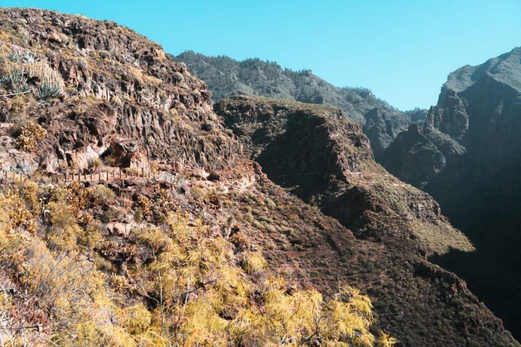
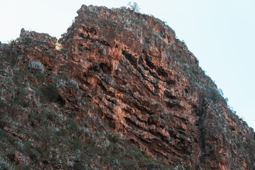
This hike takes you through the so-called Höllenschlucht, a nature reserve with unique flora and fauna.
- You’ll start on an old shepherd’s trail lined with cacti, which is mostly bathed in sunshine. There are also many spectacular viewpoints here offering views of the town of Adeje and the sea.
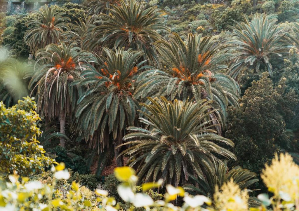
- Then we head down into the gorge, which is mostly shaded and home to many dragon trees, wild jasmine, and even a few palm trees.
- The further you go into the gorge, the narrower the path becomes, until you eventually reach the waterfall. Here you can take a short break, snap a few photos, and then hike back the same way to the exit.
- But the real highlight of this hike is the route itself. The waterfall isn't the most spectacular one I've ever seen.
Access to the hiking trail is limited to 20 visitors per half-hour. Especially during peak season and in winter, you should therefore reserve a spot for a specific time a few days in advance. It is also possible to book guided tours, during which a guide will accompany you and you can learn a lot about the nature reserve.
Important: The latest time slot for starting the route is 11:30 a.m. The trail to the waterfall is only accessible until 1:00 PM each day. This means you’ll have 1.5 hours left to walk to the waterfall entrance. That’s usually enough time, but if you want to take your time, you might only make it as far as the start of the waterfall area and then have to turn back without seeing the waterfall.
ūüŹěÔłŹ Tip: The later you start, the longer you'll have to walk in the blazing sun. That's why it's recommended to set out earlier.
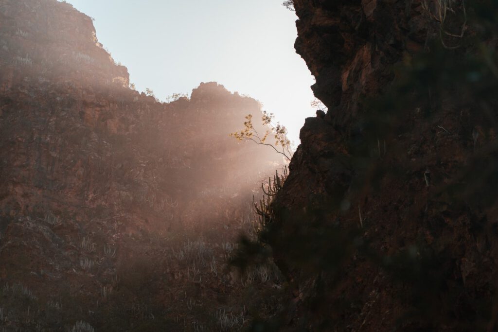
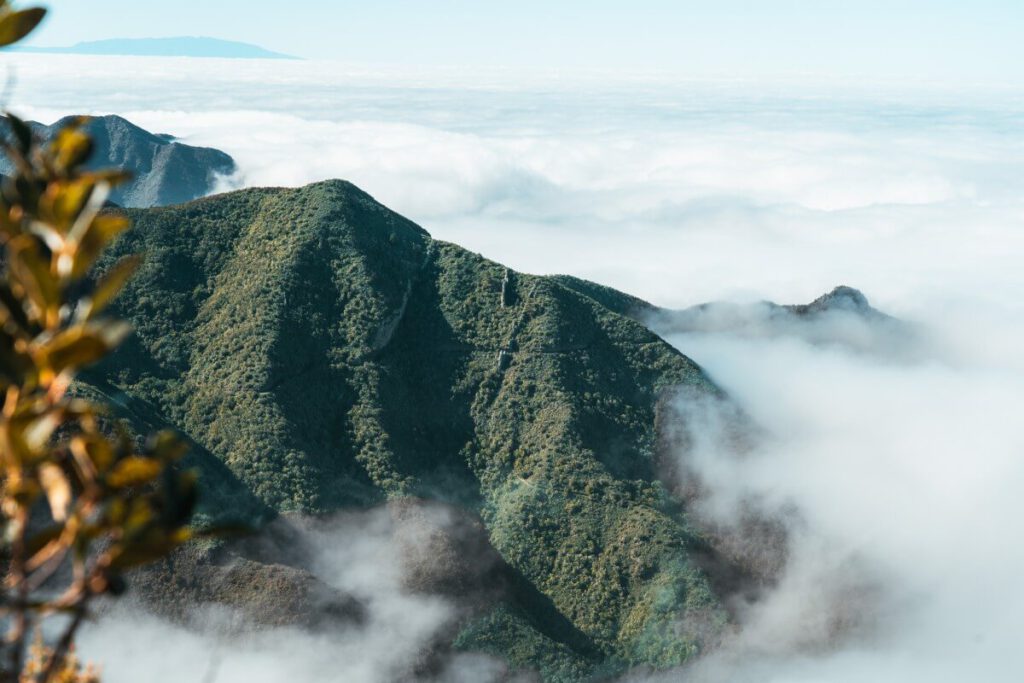
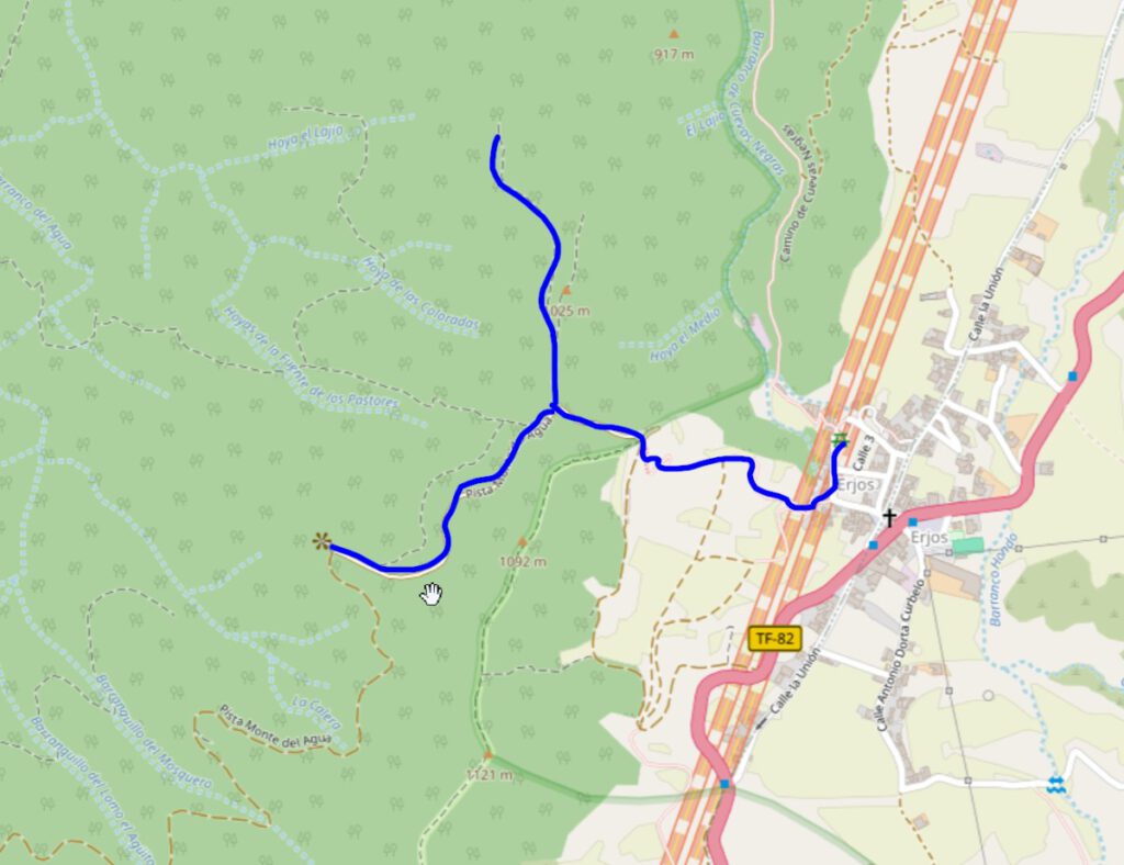
Tenerife Hike 2: Monte del Agua in Teno
- Landscape: Laurel Forest
- Nature Reserve: Teno Landscape Park
- Admission: free
- Distance: approx. 1.5‚Äď2 km
- Duration: 1‚Äď1.5 hours
- Difficulty level: low
- Parking: There are free parking spaces in Erjos
- OpenStreetMap Link
This hike is a short walk from the center of Erjos to a wooden viewing platform (Sendero Accesible Monte del Agua). The walk itself takes only about 20 minutes.
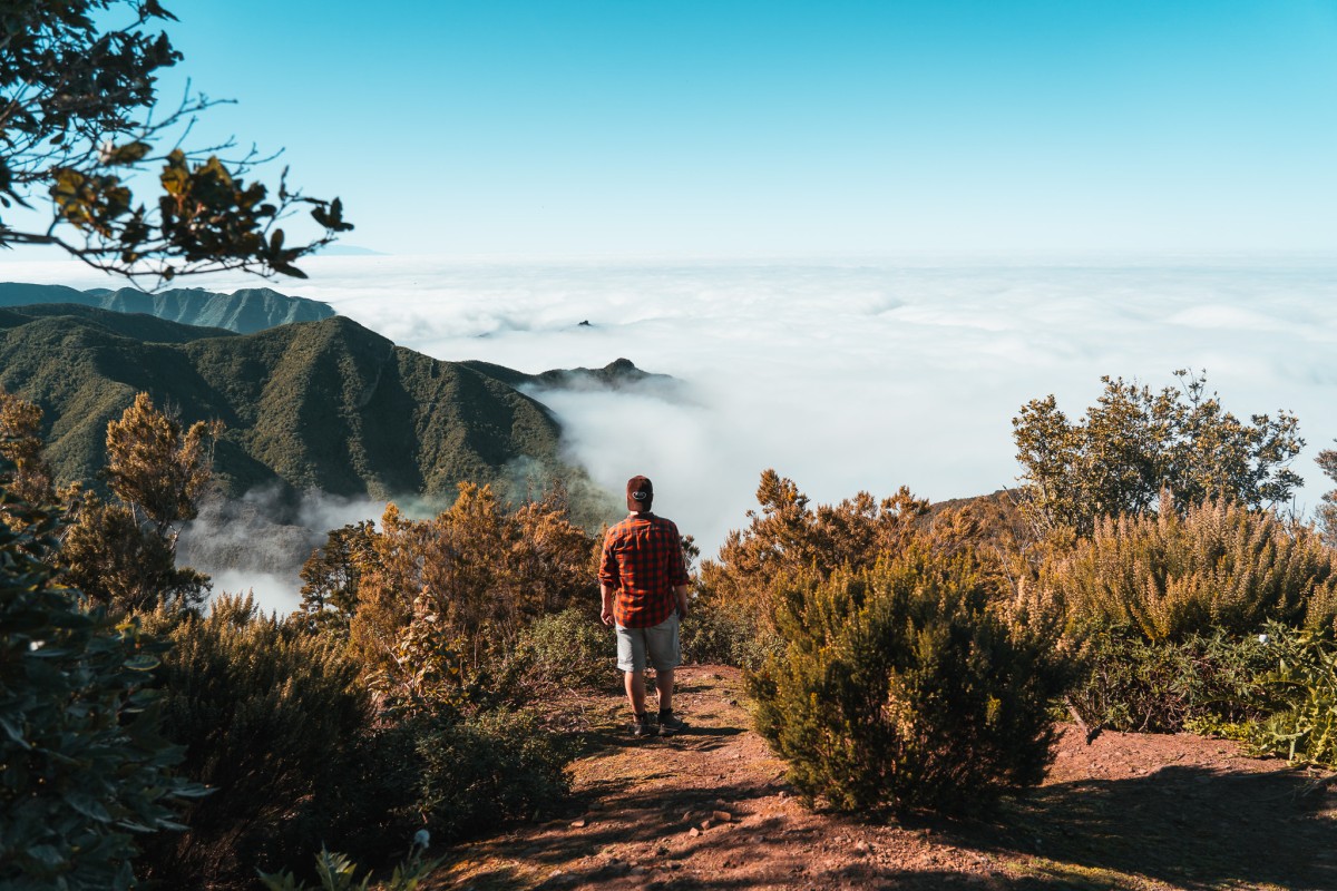
However, there is a side trail along the route that leads over a small mountain ridge to an even more spectacular view above the clouds, where few tourists ever venture.
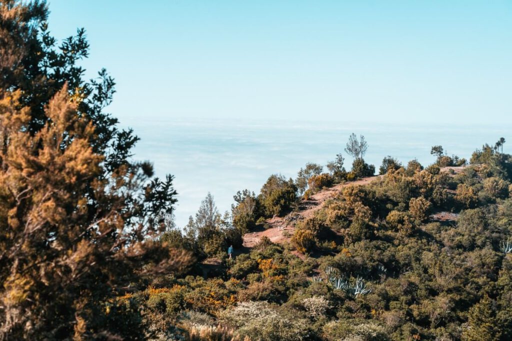
When the weather is right, you’ll be treated to fantastic panoramic views of the green mountains rising above the cloud cover.
It’s best to use OpenStreetMap so you can see the turnoffs on the map as well.
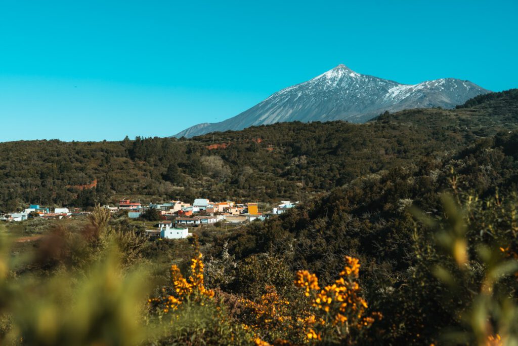
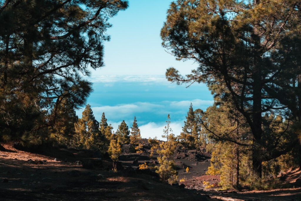
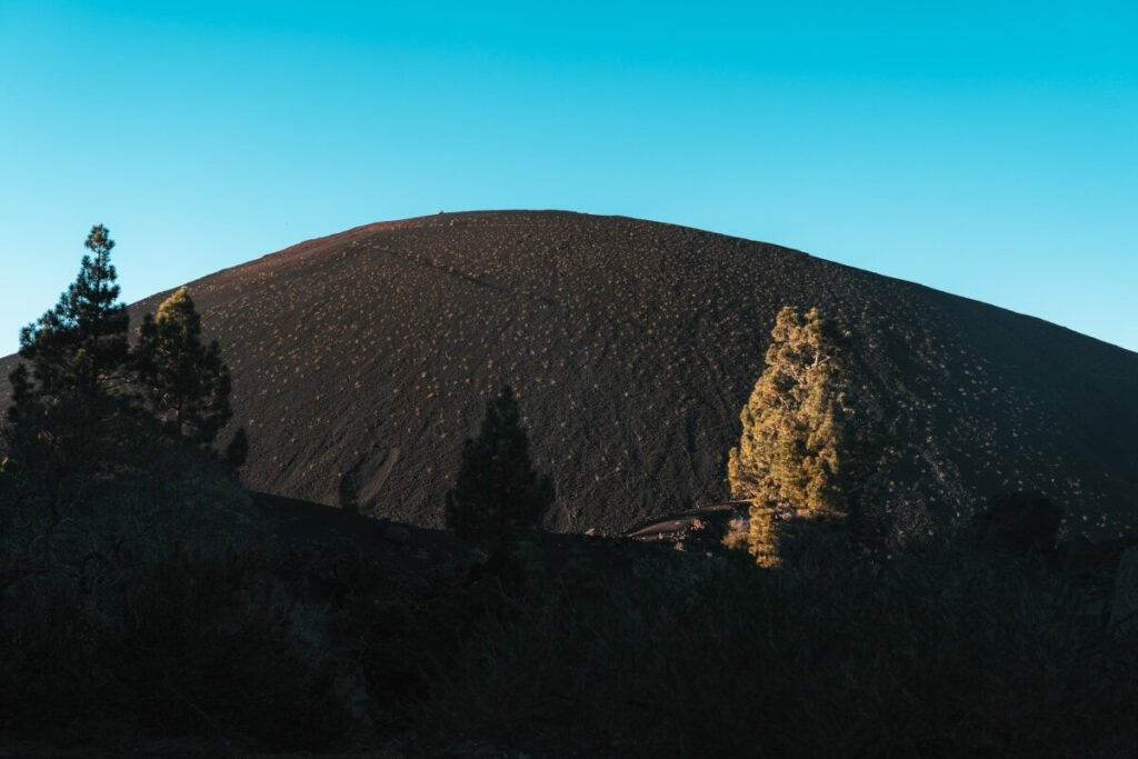
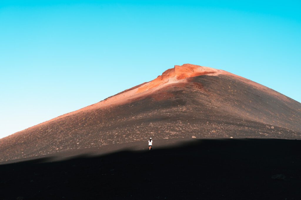
Tenerife Hike 3: Monta√Īas Negras in Chinyero
- Landscape: Volcano
- Nature Reserve: Chinyero Special Nature Reserve
- Admission: free
- Route: approx. 4 km (you can find a slightly longer version here)
- Duration: 1.5 hours (round trip)
- Difficulty level: easy
- Parking: There is a parking lot (Parking Arenas Negras) at the volcano, featuring a playground, a barbecue area, and restrooms
- OpenStreetMap Link
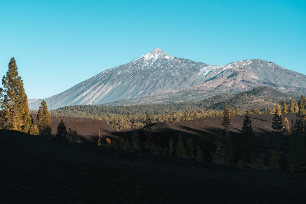
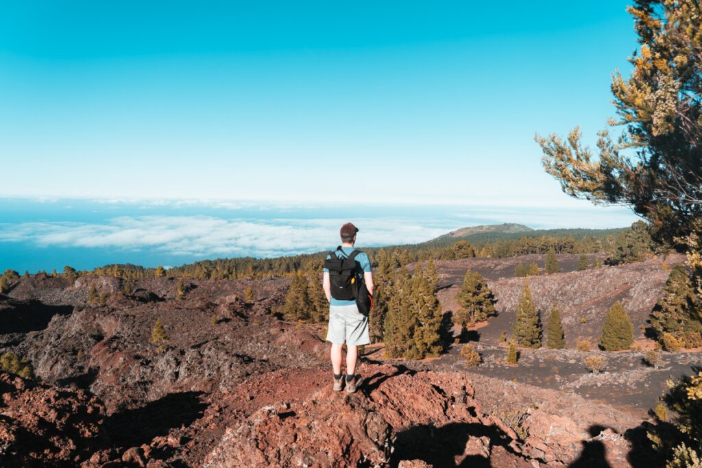
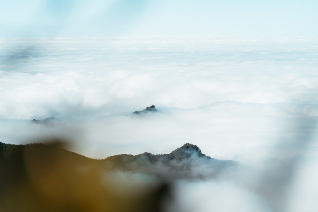
On this hiking trail, you’ll walk across rocky volcanic fields, past volcanic cones, and over black volcanic soil dotted with green pine trees. Along the way, you’ll enjoy fantastic views of the often cloud-covered sea and Mount Teide.
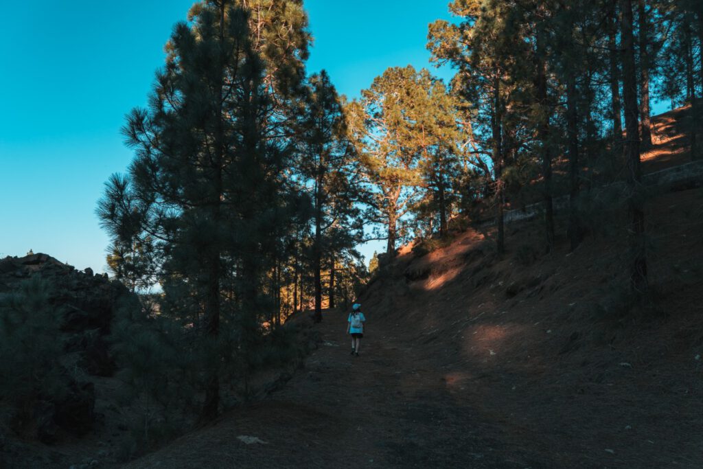
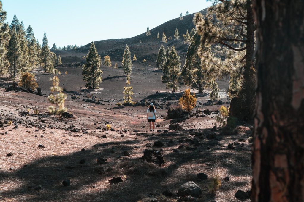
This route was one of my absolute favorites. If you have more time, you can explore the entire Chinyero region further on countless hiking trails.
ūüĆč Please note: For conservation reasons, access to the volcanic cones of Monta√Īa Garachico, Monta√Īa Chinyero, and Monta√Īas Negras is prohibited.
For this loop hike, start at the ‚ÄúZona recreativa las arenas negras,‚ÄĚ where the parking lot is located. From there, follow the stone-lined path until you reach a lava field. The trail then winds through a pine forest up the mountain to the water channel. From there, you have several options for returning to the parking lot. You can either take the dirt road around Montana Negra.
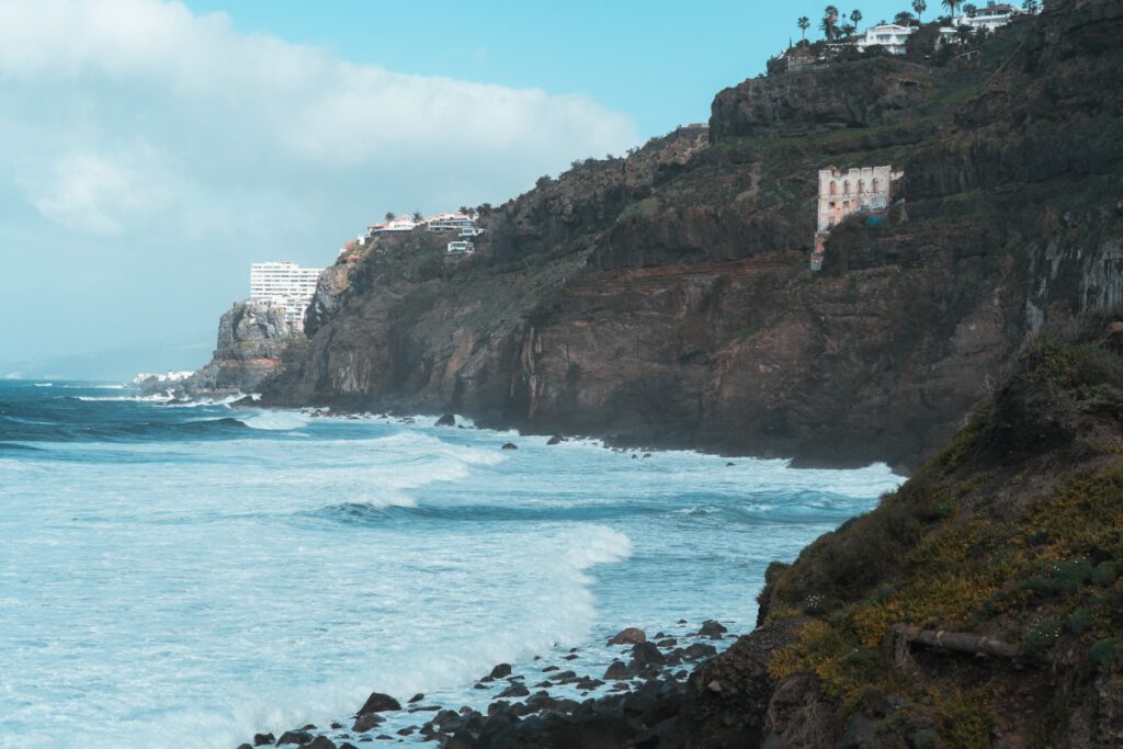
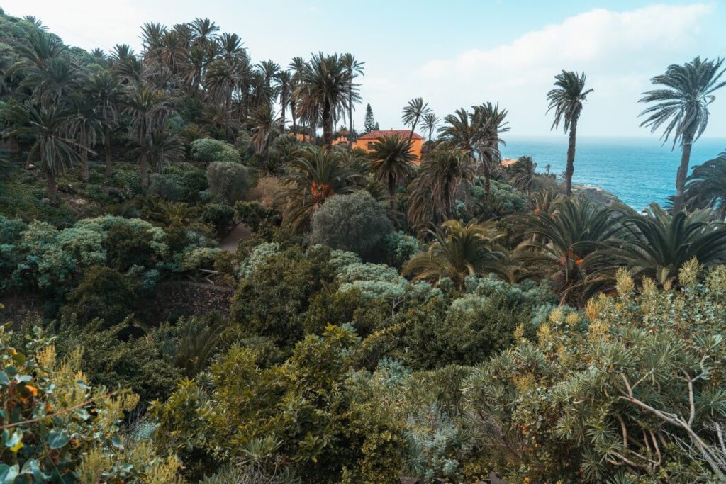
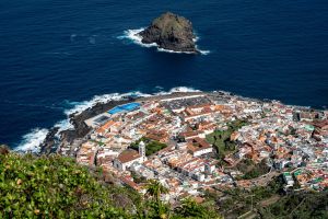
Tenerife Hike 4: At Playa Castro
- Landscape: Coast
- Nature Reserve: Rambla de Castro Landscape Protection Area
- Admission: free
- Distance: approx. 2 km
- Duration: 1.5 hours
- Difficulty level: moderate (due to the many ups and downs)
- Parking: There are several free parking spaces at the Restaurante Cafetería Mirador San Pedro
- OpenStreetMap Link
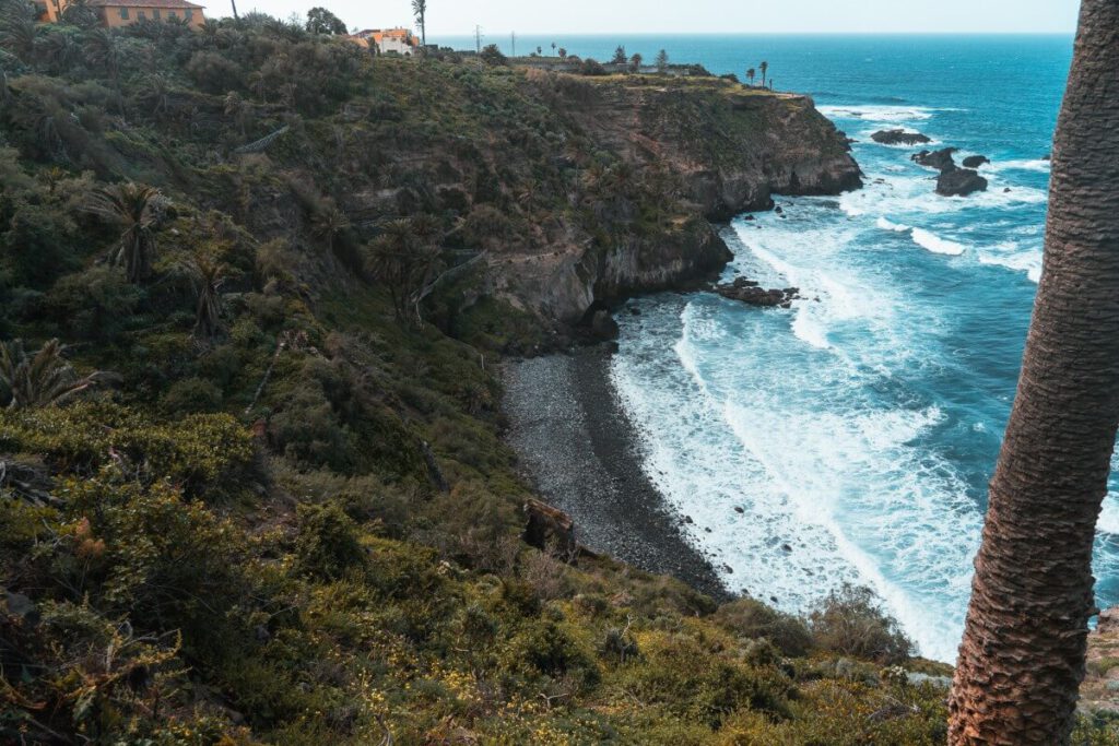
At Playa Castro, you’ll find steep cliffs, hidden coves, and secluded beaches. Along the way, you’ll walk through a jungle full of Canary Island palm trees, passing by scenic overlooks and abandoned ruins.
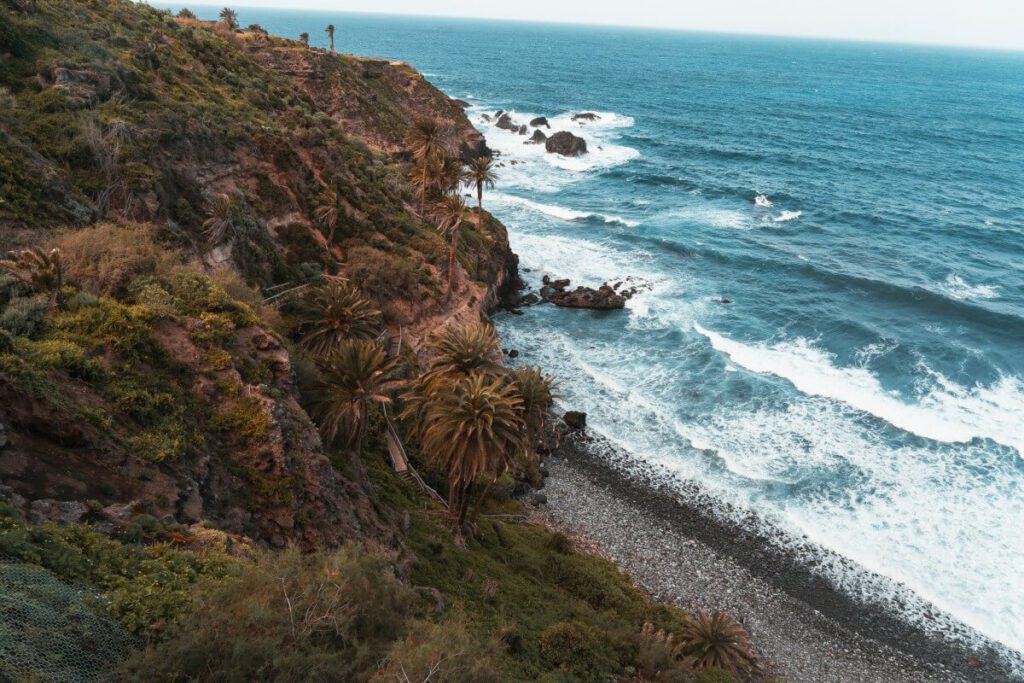
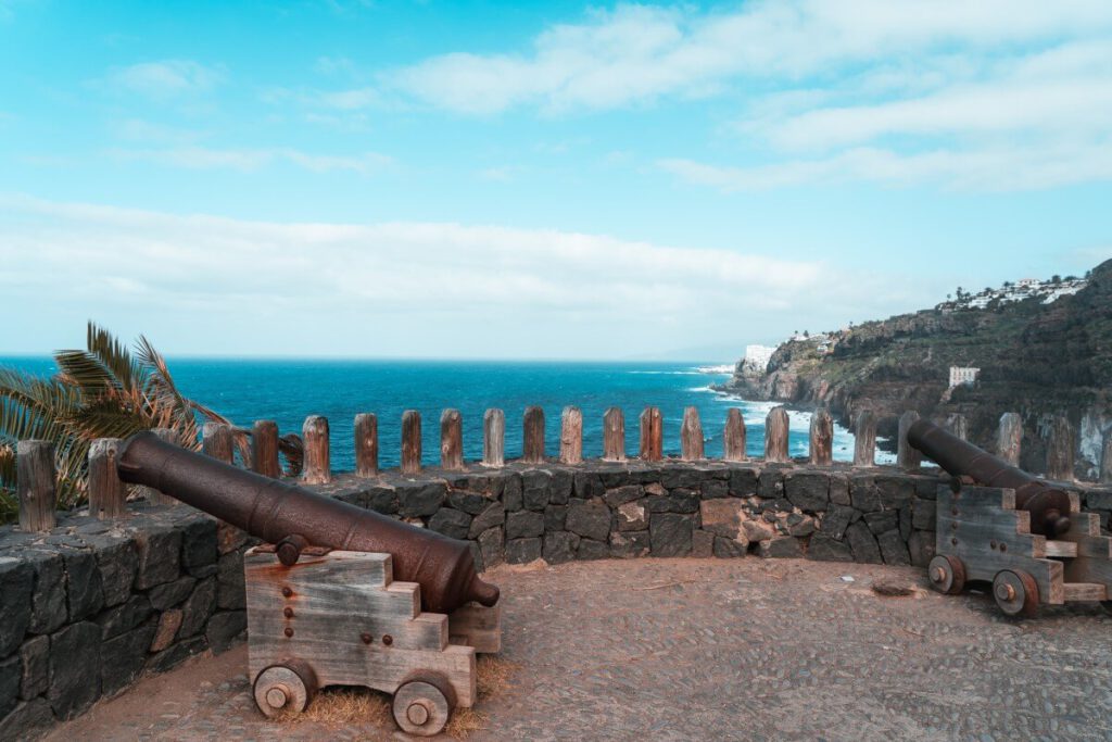
Start at the café near the Mirador San Pedro and walk downhill to La Casona, the former residence of the Castro family, after whom the region is named. From there, make your way through the lush undergrowth down to the beach (if the path is open). Then you walk back up, following the path along the cliffs to the Fortin de San Fernando with its cannons. From here, you have the best view. If you have enough energy, you can walk down the stairs to Los Realejos Beach near the ruins. From there, you take a slightly different path back to the starting point.
In theory, the trail continues on to the ruins of Gordejuela, the old hydroelectric power plant. However, if you want to visit it, you’ll need to allow about twice as much time.
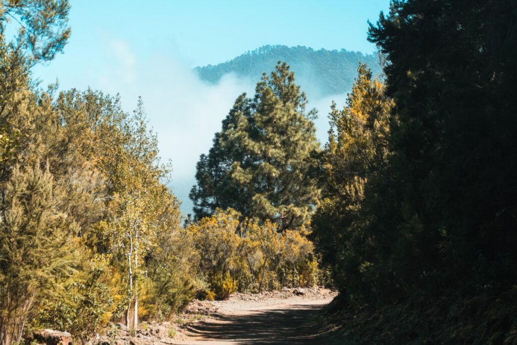
Tenerife Hike 5: Camino de la Orilla del Monte
- Landscape: Forest
- Nature Reserve: Corona Forestal Nature Park
- Admission: free
- Distance: 3.8 km
- Duration: approx. 2 hours
- Difficulty level: easy
- Parking: There are plenty of free parking spaces at the La Caldera recreation area and along the street leading up to it
- OpenStreetMap Link
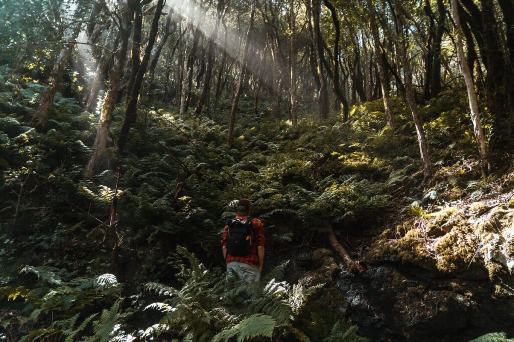
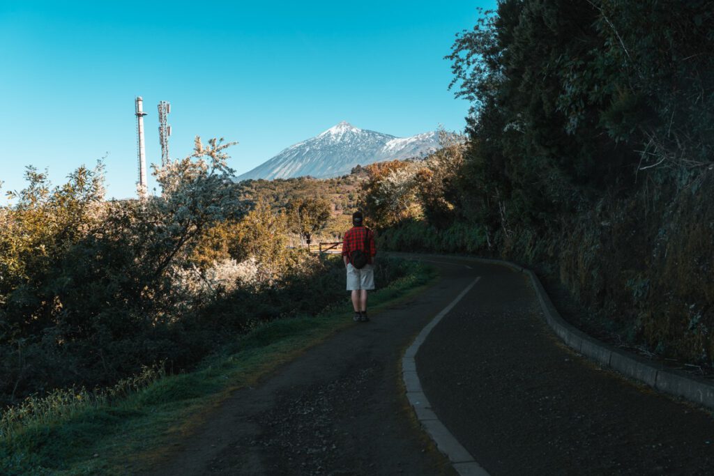
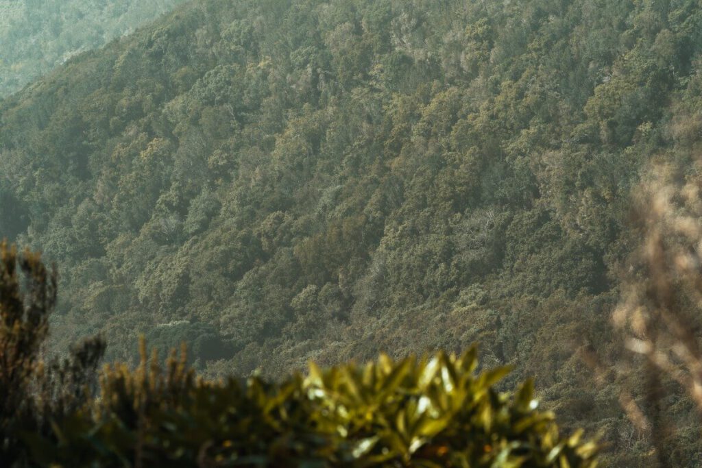
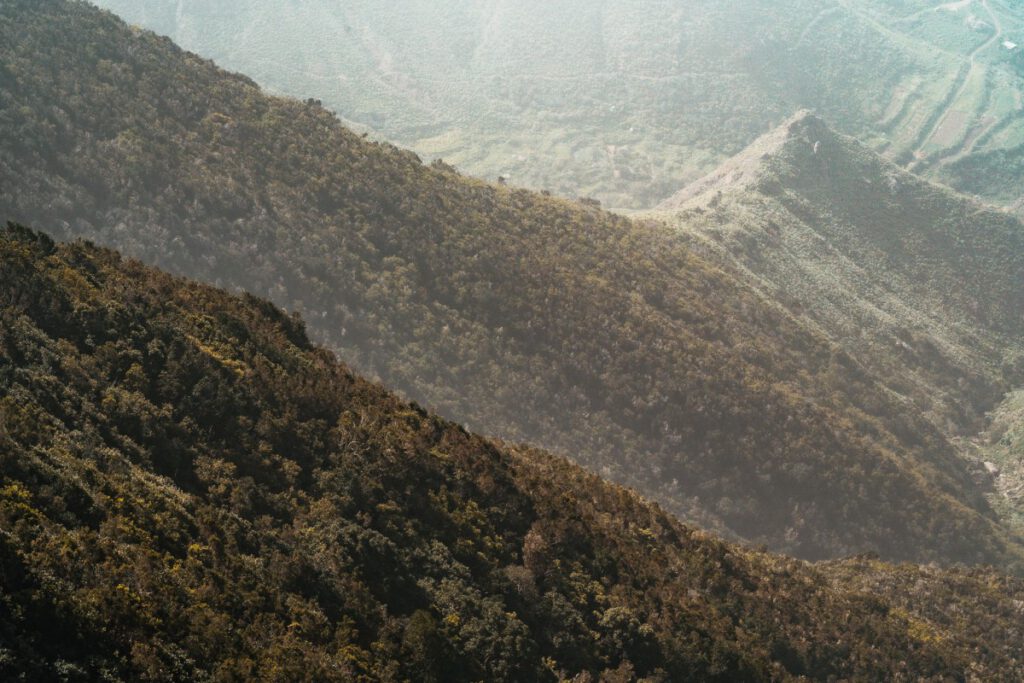
The Corona Forestal Nature Park is the largest nature reserve in the Canary Islands and is often referred to as the ‚Äúgreen lung‚ÄĚ of Tenerife. This nature park encircles Teide National Park like a crown and is covered with pine forests and even some areas of laurel forest.
You can explore a small part of it on this loop trail, a detailed description of which can be found on Tenerife On (SL TF 81). There are also shorter versions of this route where you simply turn back earlier. The starting point is at the La Caldera recreation area, which is often visited by locals, especially on holidays and weekends. There are restrooms, picnic areas, tables, and a large green space with a playground in the middle of the crater‚ÄĒperfect for a picnic after the hike.
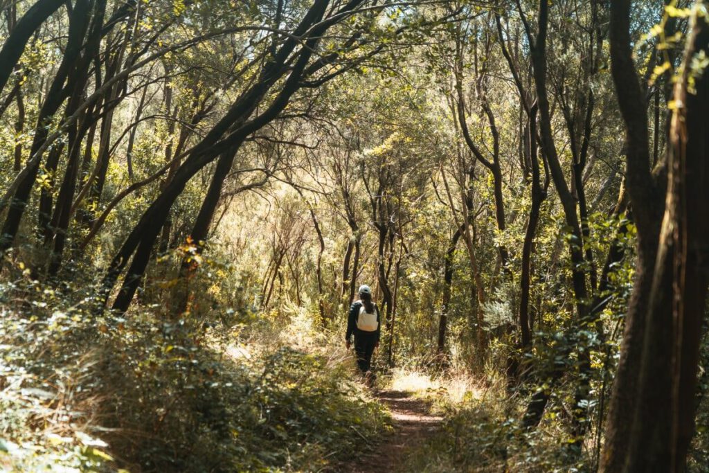
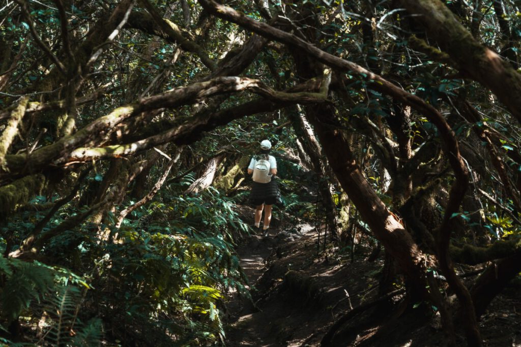
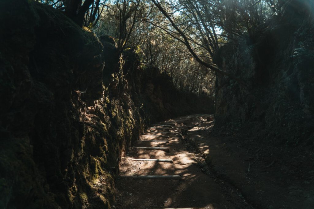
Tenerife Hike 6: Loop Trail in El Pijaral
- Landscape: Jungle
- Nature Reserve: El Pijaral Integral Nature Reserve (located within the Anaga Regional Park)
- Admission: free, but reservations are required
- Distance: 6 km
- Duration: 3 to 4 hours
- Difficulty level: medium
- Parking: At the trailhead (La Ensillada bus stop), there is a parking bay along the road that can accommodate about 15 to 20 cars.
- OpenStreetMap Link
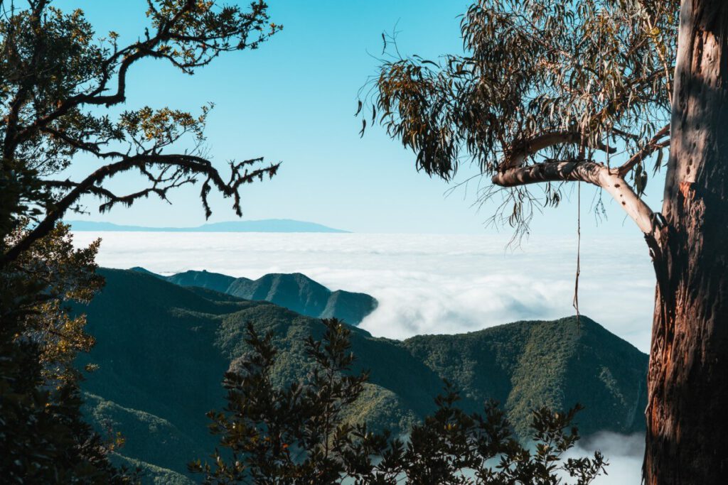
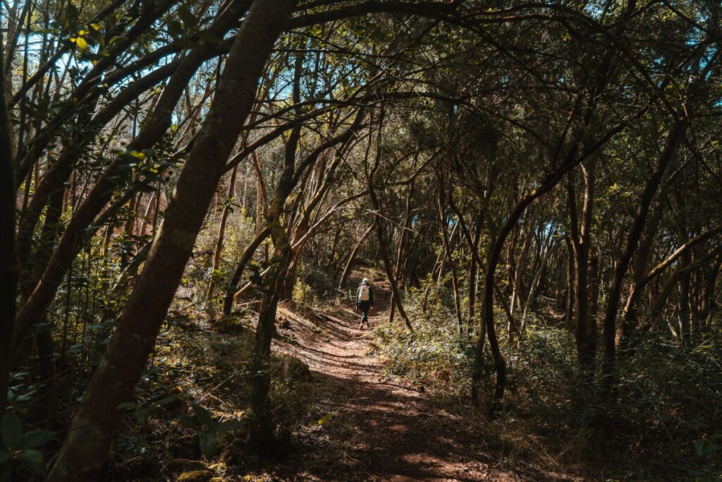
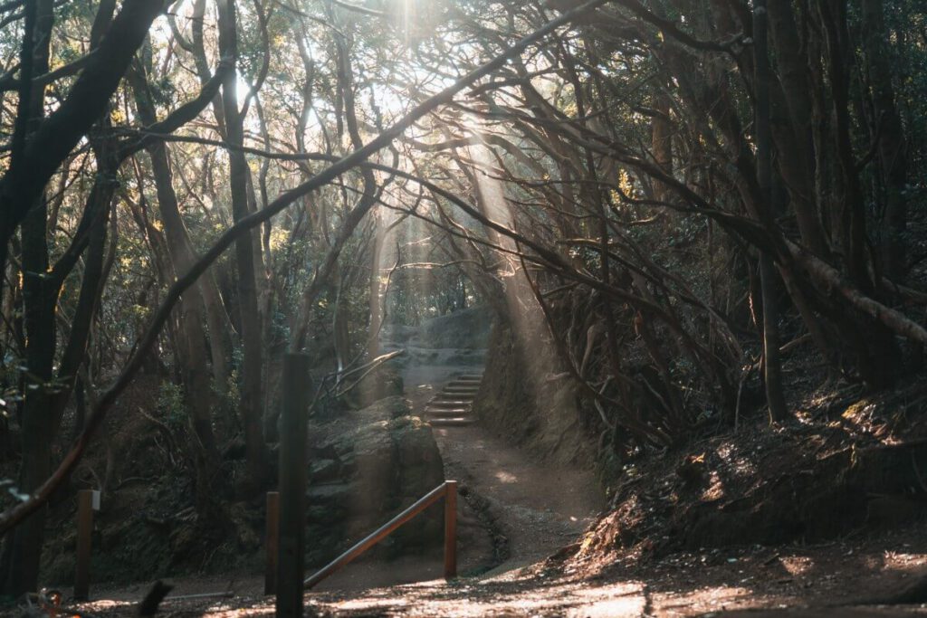
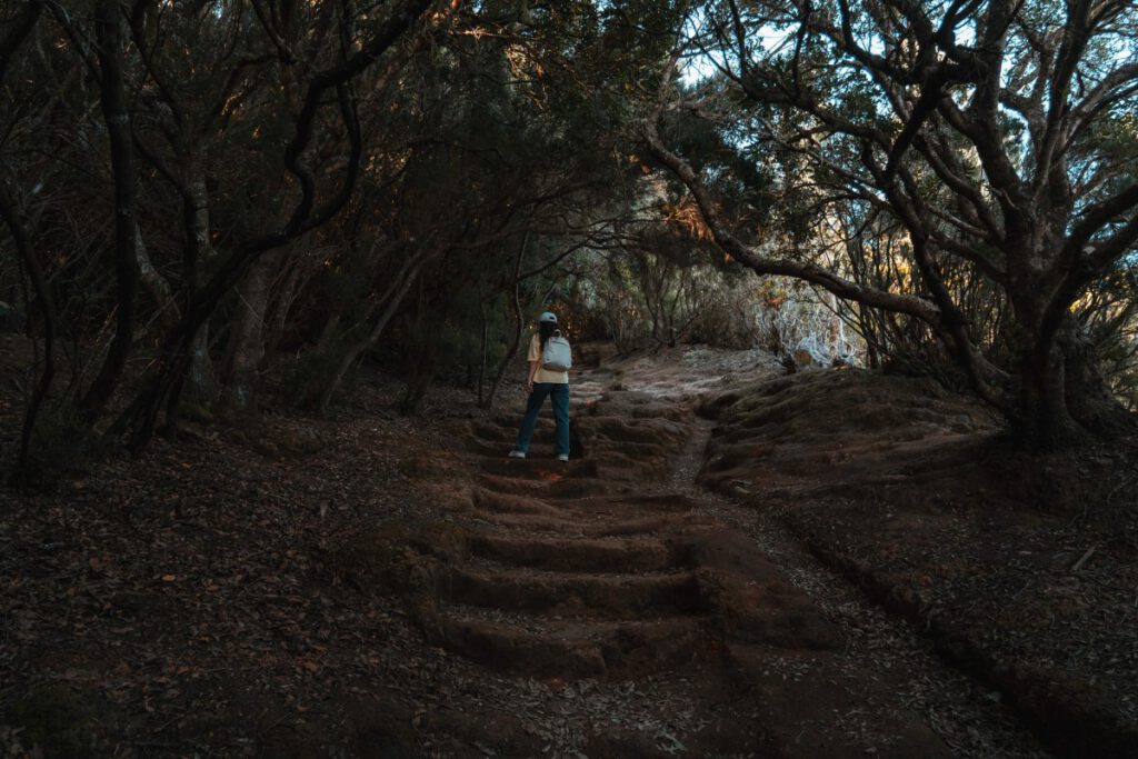
El Pijaral is a specially protected area within the Anaga Regional Park. Due to its steep slopes and deep ravines, this area has always been very difficult for people to access. That is also why the forest here is in such excellent condition. This loop trail takes you along the edge of this natural wonder through the secluded jungle to the Cabezo del Tejo viewpoint. From there, you’ll have a fantastic view of the north coast of the Anaga Mountains and the village of Taganana. Along the way, you won’t encounter many people, so you can fully enjoy the natural surroundings.
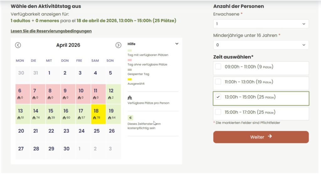
This hike in Tenerife is also known as the La Ensillada‚ÄďCabezo de Tejo‚ÄďLa Ensillada loop, and you can only hike it if you‚Äôve made a reservation online in advance. It‚Äôs easy to do on the Tenerife On website once you‚Äôve created a free account there. But you‚Äôll need to act fast, as there are only 100 spots available per day, spread across 4 different time slots (25 spots per slot). You can usually book for the next 2 weeks. Once those slots are filling up, new dates become available for the following 2 weeks.
If you don’t obtain a permit and are caught hiking through the nature reserve, you could face hefty fines. If you do manage to secure one of the coveted spots, be sure to take some time during your hike to discover the beautiful details of this unique natural wonder.

Tenerife Hike 7: Path of the Senses 3 (Sendero de los Sentidos)
- Landscape: Laurel Forest
- Nature Reserve: Anaga Landscape Park
- Admission: free
- Distance: 1.3 km
- Duration: 45 minutes
- Difficulty level: easy
- Parking: There are a few free parking spaces next to the visitor center
- OpenStreetMap Link
It’s best to visit this trail very early in the morning or in the evening, when the nearby visitor center has already closed. That’s because there are always quite a few tourists here. However, the trail, which leads through the local laurel forest to the Mirador del Llano de los Loros, is still very beautiful and is probably the most accessible hiking trail in the entire Anaga Mountains.
There are also two shorter versions: the Path of the Senses 1 (accessible to wheelchair users) and the Path of the Senses 2.
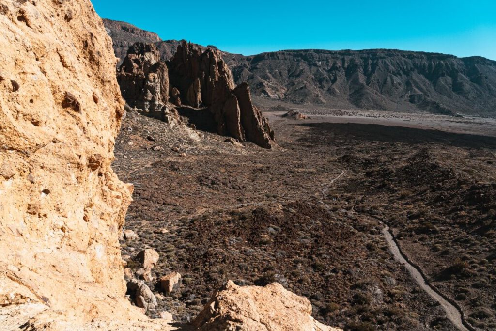
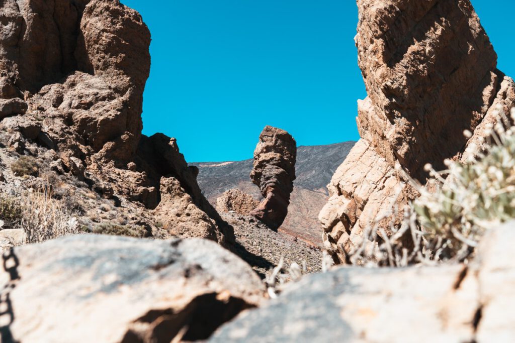
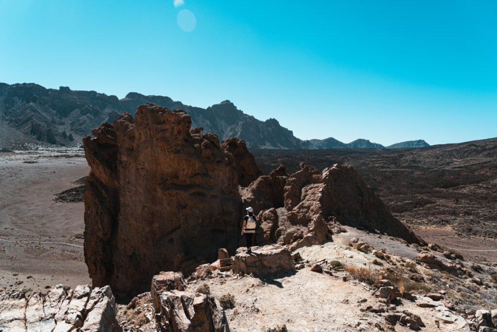
Tenerife Hike 8: Roques de García in Teide
- Landscape: Volcanic landscape
- Nature Reserve: Teide National Park
- Admission: free
- Distance: 3.5 km
- Duration: 2.5 to 3 hours
- Difficulty level: medium
- Parking: There are several free parking spaces
- OpenStreetMap Link
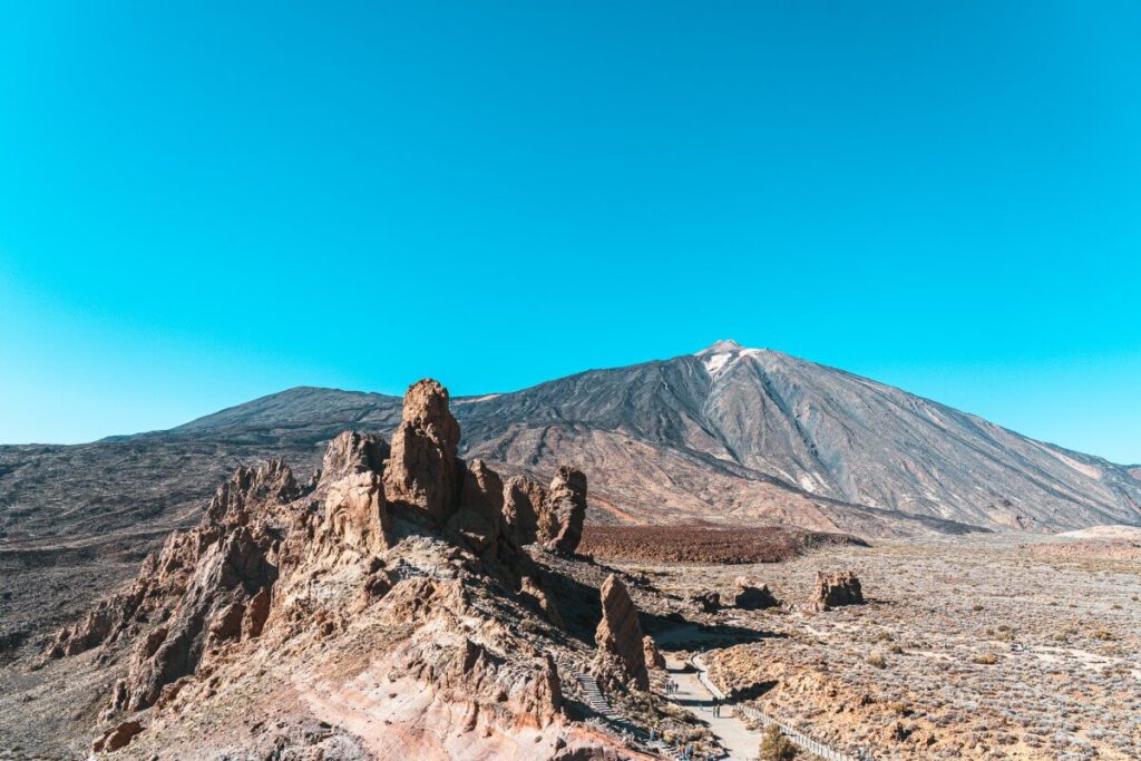
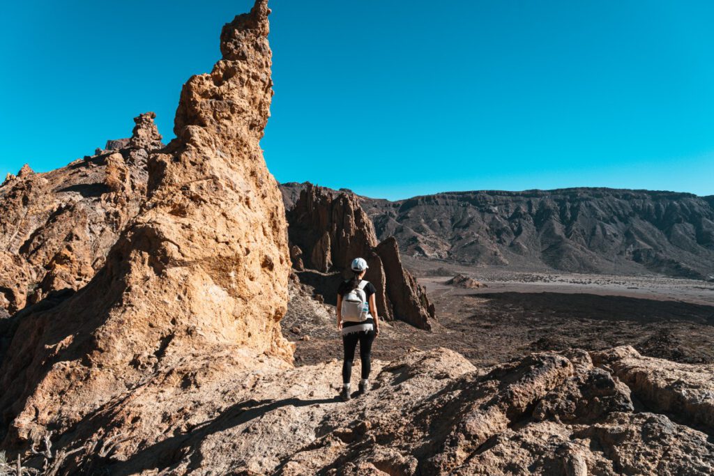
The Roques de Garc√≠a loop trail (PNT 03) attracts a lot of tourists, but very few of them actually hike it. Most just stop briefly to take a photo of the postcard-perfect Roque Cinchado rock (the ‚ÄúFinger of God‚ÄĚ) with Mount Teide in the background, and then drive on. As a result, the parking lots here are often packed.
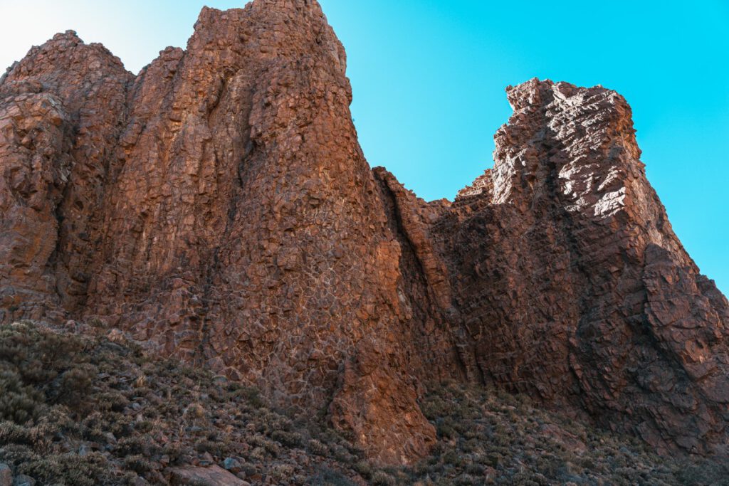
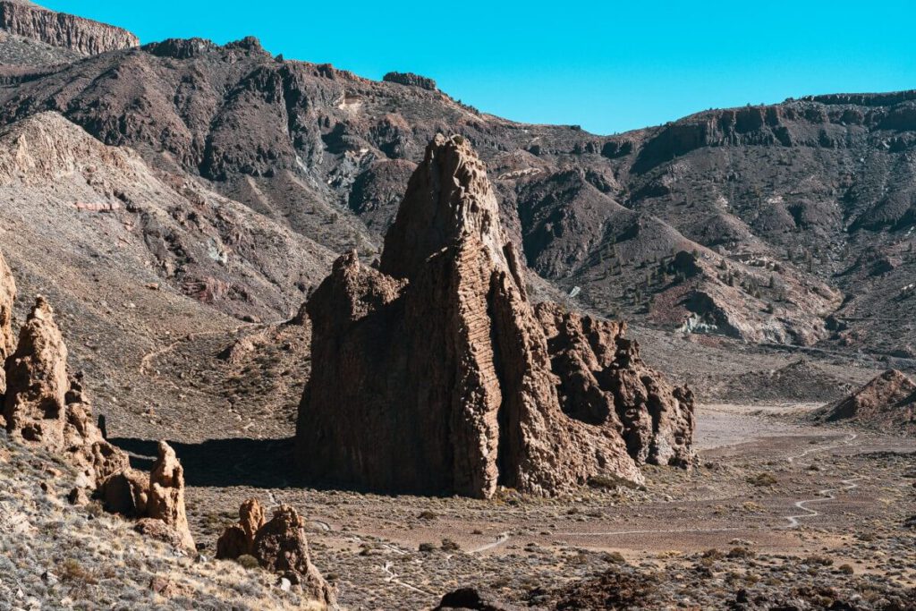
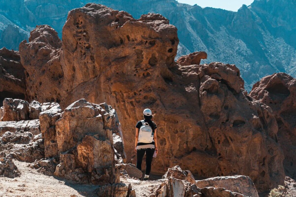
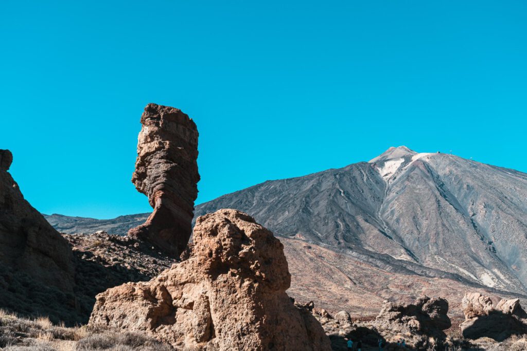
But you should definitely take more time to do the circular hike, which feels a bit like a mission to Mars, passing by veritable rock cathedrals that rise from the ground like frozen giants. One rock formation looks more surreal than the next, and the spectacular view of the dusty emptiness of Teide National Park is sure to haunt your dreams for nights to come.
ūüŹĒÔłŹ Tip: Run the course counterclockwise. That way, you'll tackle the steepest part right at the start.
Tenerife has countless amazing hiking trails that take you through a wide variety of landscapes. Which hike is your favorite? Which hike should definitely be added to this list? Let us know in the comments!
Tools & services I recommend for your trip:*
📶 Flexible and affordable mobile Internet worldwide
🚁 My drone for aerial photography
🚗 Find and compare cheap rental cars
🎟 Find and book cool activities
🔒 Secure Internet connection with NordVPN
*Note: These links are affiliate links. If you book through them, I will receive a small commission without it being more expensive for you. A purchase from you via these links helps me to continue offering free content without annoying ads on this website. Thank you for your support! I really appreciate it!

Leave a Reply